within 5 minutes to merano
Close to the Spa Town

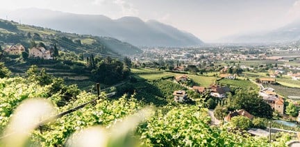
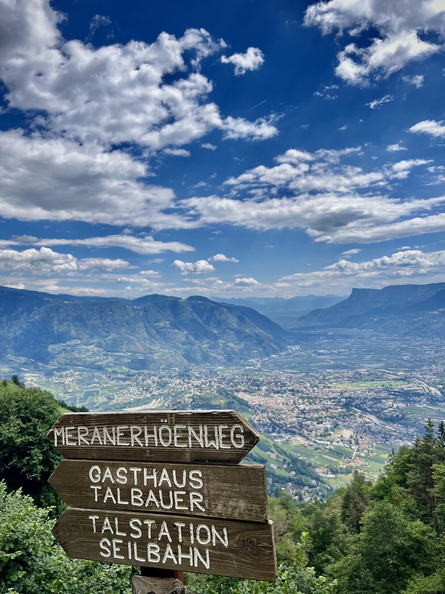
The Meran High Mountain Road is one of the most beautiful high-Alpine circular trails in Europe. At a length of 100 kilometres, it surrounds South Tyrol’s largest nature park, the Texel Group Nature Park, at an altitude of approx. 1,400 metres. There are altitude differences at around 100 metres along the way. The Texel Group is situated between the Italian-Austrian border, the Meran basin, the Passeier Valley and the Schnals Valley.
The Meran High Mountain Road is divided into a Northern and a Southern route. The northern part of the mountain road has its peak at the Eisjöchl, which is at an altitude of 2,895 metres. In the southern realm, you can reach an altitude of 1,839 metres at the Hochganghaus Hut.
Depending on your condition and the length of the stages you choose, it will take you between 3 and 8 days to cover the entire circular route. No fear! Along the way, there are numerous Alpine huts, offering South Tyrolean delicacies and protection from the rain and storms. Please check out the opening times of the individual huts.
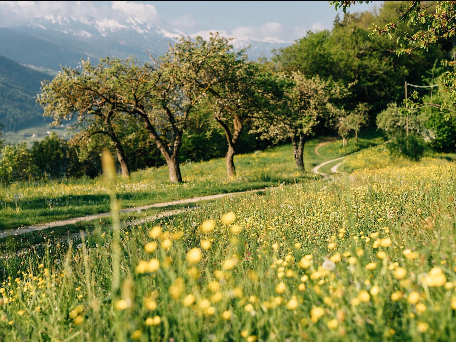
Lagundo is situated at the southern side – also called the sunny side. The route leads you along the southern slopes of the Texel Group. Enjoy breath-taking panoramic views of an impressive cultural landscape, particularly the Vinschgau region, as well as the Burgrave’s office and the Passeier Valley. In general, the southern part is recommended for trips from May to November. Some parts of the route are walkable all year round – depending on the weather conditions.
There are many places of natural beauty along the High Mountain Road waiting to be discovered and definitely worth seeing. Enjoy the breath-taking views of the impressive Tschigat peak (2,998 metres), the Mutspitze (2,294 metres), as well as the Matatzspitze (2,179 metres). Another highlight is the Partschins waterfalls, which roars down from a height of 97 metres and is therefore one of the highest South Tyrolean waterfalls. In addition, there are the Spronser Lakes, the highest located Alpine lake area in South Tyrol with 10 lakes at an altitude of 2,117 metres to 2,589 metres.
While walking, you will keep coming across mountain farmhouses, which are several hundred years old and have marked the Alpine landscape enormously. In the old days, farmhouses were built on higher ground due to insufficient space in the valley regions. You can imagine that cultivation at such an altitude was quite difficult – and still is today.
The Northern part of the High Mountain Road has a high-Alpine characteristic. It leads through the Pfossen and Pfelder Valleys. The Eisjöchl at an altitude of 2,895 metres is the highest point and divides the valleys from each other. Due to its high-Alpine character, the Northern part can only be accessed through the summer months, from June to September.
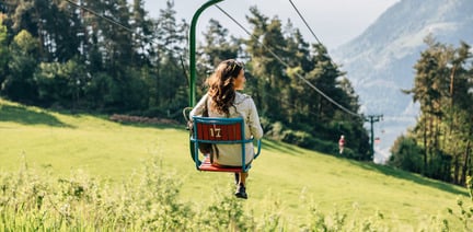
A particularly beautiful way of reaching the Meraner Höhenweg high alpine trail from Algund/Lagundo is by taking the chair lift to Vellau/Velloi (906 m) and then South Tyrol’s only gondola basket lift to the Leiter Alm mountain hut (1,450 m) situated directly at the Meraner Höhenweg high alpine trail. You can also reach the Meraner Höhenweg high alpine trail on foot from Vellau/Velloi along trail no. 25 or trail no. 25A to the Leiter Alm mountain hut. Sure-footed hikers who have no head for heights can also take the Vellauer Felsenweg trail no. 22 up to the Hochmuth restaurant from Vellau/Velloi and then continue along the Meraner Höhenweg high alpine trail until the Leiter Alm mountain hut. (In this case, the hiking time of the 1st stage is correspondingly longer). This is a proposal for discovering the Meraner Höhenweg high alpine trail in 6 stages starting at the Leiter Alm mountain hut:
1st stage: Leiter Alm mountain hut – Hochganghaus refuge (approx. 1.5 hours) Hochganghaus refuge – Nasereit refuge (approx. 2.5 hours) Nasereit refuge – Giggelberg restaurant (approx. 1.5 hours) Hiking time: approx. 5.5 hours
2nd stage: Giggelberg restaurant – Hochforch inn (approx. 45 min) Hochforch inn – Pirch inn – Grub inn (approx. 1.5 hours) Grub inn – Gallmein inn – Innerforch inn – Lint restaurant (approx. 45 min) Lint restaurant – Unterperflhof farm– Katharinaberg/Monte S. Caterina (approx. 2 hours) Hiking time: approx. 5 hours
3rd stage: Katharinaberg/Monte S. Caterina – Vorderkaser inn (approx. 3.5 hours) Vorderkaser inn– Eishof inn (approx. 2 hours) Hiking time: approx. 5.5 hours
4th stage: Eishof inn – Eisjöchl pass – Stettiner Hütte refuge (approx. 3 hours) Stettiner Hütte refuge – Plan (approx. 3 hours – descent!) Hiking time: approx. 6 hours
5th stage: Pfelders/Plan – Innerhütt restaurant (approx. 1 hour) Innerhütt restaurant – Ulfas (approx. 1.5 hours) Ulfas – Kristlhof inn (approx. 1.5 hours) Kristlhof inn– Matatz (approx. 1 hour) Hiking time: approx. 5 hours
6th stage: Matatz – Magdfeld restaurant (approx. 1.75 hours) Magdfeld restaurant – Vernuer/Vernurio (approx. 2 hours) Vernuer/Vernurio – Gfeis/Gaveis (approx. 0.75 hours) Gfeis/Gaveis – Longfall restaurant (approx. 1 hour) Longfall restaurant – Hochmuth restaurant (approx. 1.5 hours) Hochmuth restaurant – Leiter Alm mountain hut (approx. 1 hour) Hiking time: approx. 8 hours
There is a parking lot next to the chair lift to to Vellau or next the cable car to Leiter Alm. The parking lot is only available for those who used the chair lift or the cable car.
By bus line 235 to Algund, Mitterplars, bus stop at the chair lift or up to Vellau.


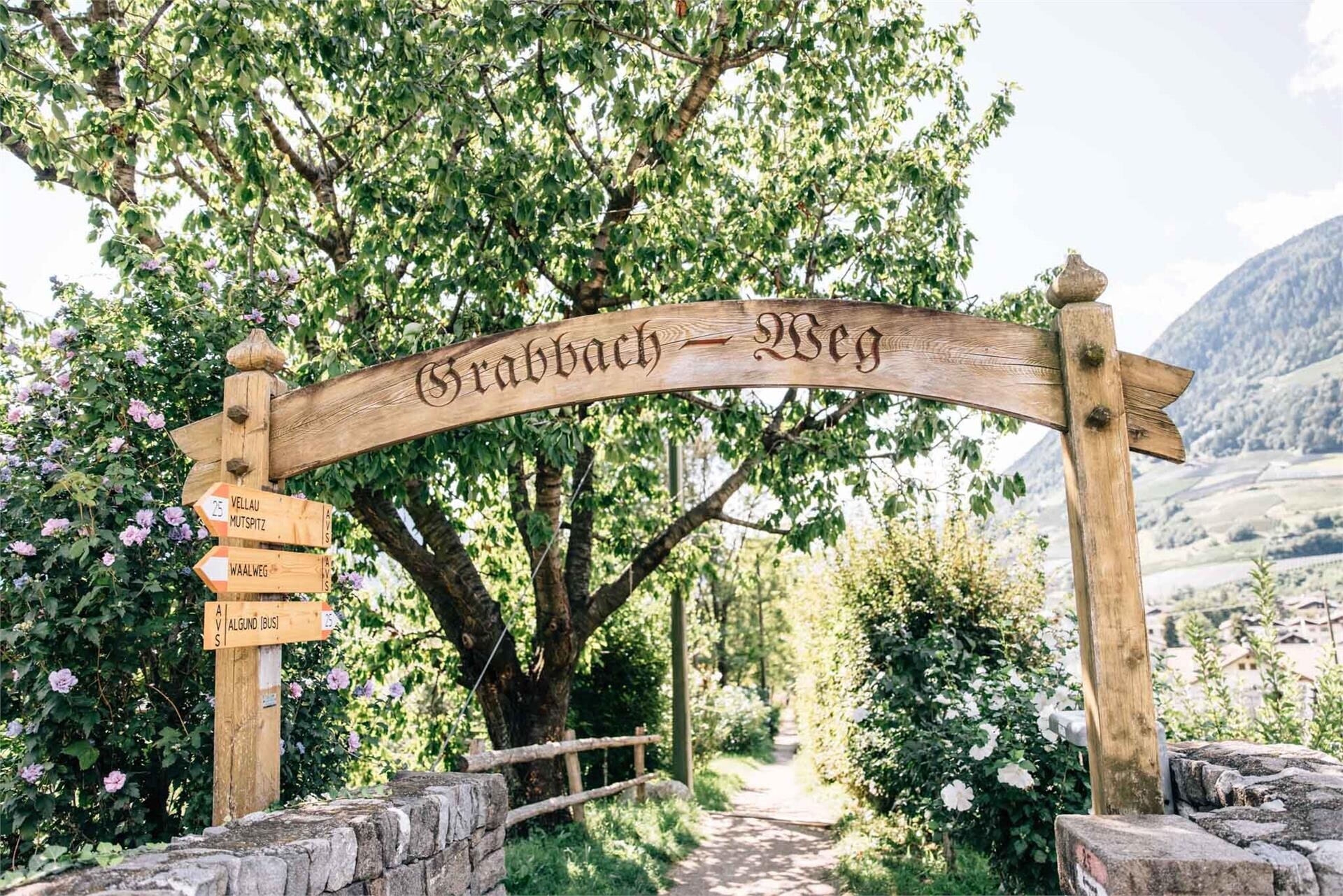
Follow the Grabbachweg trail until Café Konrad and continue along path no. 25A up to the Schlundenstein, a large rock from the Ice Age. From there take path no. 21 that ...