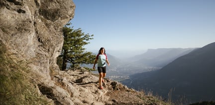
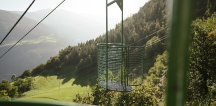
Tschigat (3,000 m) from the Leiter Alm mountain hut
The Tschigat is a striking peak in the Texel Group. The pyramid formed from gneiss offers a magnificent view of many mountain peaks. The tour to the Tschigat is not just a hike, but a real mountain tour with easy climbing passages (grade 2) in exposed terrain. Experience, a good physical condition, sure-footedness, a head for heights and stable mountain weather are prerequisites (dangerous with ice and snow).
The starting point of this tour is the Leiter Alm mountain hut reachable by gondola basket lift from Vellau/Velloi. First hike along the Meraner Höhenweg high alpine trail no. 24 westwards until the Hochganghaus refuge (1,839 m) and continue along the steep, exposed trail no. 7 secured with ropes and chains up to the Hochgangscharte pass (2,455 m). Passing by the Langsee lake and the Milchseen lakes, the increasingly steeper trail leads over boulders towards the eastern flank and through the large gully up to the summit structure. Next comes a moderately difficult climbing part and a short, very exposed part to the right before you reach the large rock slabs leading to the summit. Descent: Either along the same route or a longer variant over the west ridge with short exposed and partly secured passages down to the Halsljoch pass. From there, the route leads eastwards to the Milchseescharte pass (Guido Lammer bivouac) and then over steep, secured rock steps down to the Milchseen lakes. Continue until the Hochgangscharte pass and descend to the Hochgangshaus refuge and to the mountain station of the gondola basket lift near the Leiter Alm mountain hut.
- Parking lot Algunder Waalweg
- Algund town hall
- Parking lot chairlift Mitterplars
- Parking at the terminal of the Vellói - Vellau cable car
With the bus 235 or 213 to the valley station of the chairlift.
Fancy a hiking holiday in Algund?
We will gladly help you to plan your holiday in Algund.
Nature & Adventure path in Marling
Duration: 0h 30 | Length: 1,1 km | Highest point: 553 m
The Eichhörnchenweg trail trail in Marling/Marlengo functions as an educational nature trail and is identified with the emblem of a squirrel. The one km ...
Lagundo - Leiter Alm mountain hut
Duration: 4h 1 | Length: 7,85 km | Highest point: 1519 m
The Leiter Alm is located directly at the well-known Meraner Höhenweg at 1550 m.
It is located in the heart of the Nature Park Texelgruppe and is an ideal starting ...


